Weather information products tailored to client specifications. 24x7 product generation and archival. Reference: The Patient and the Weather The ERRExInc Vitality Index is a WxOps® Weather Information Service provided by WxAnalyst LTD.
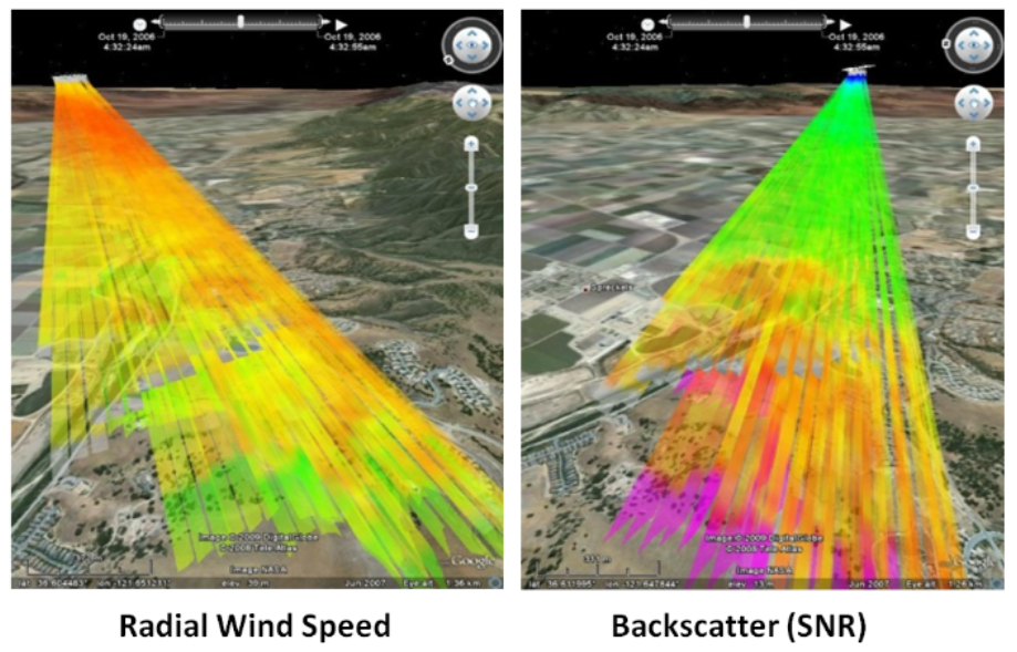
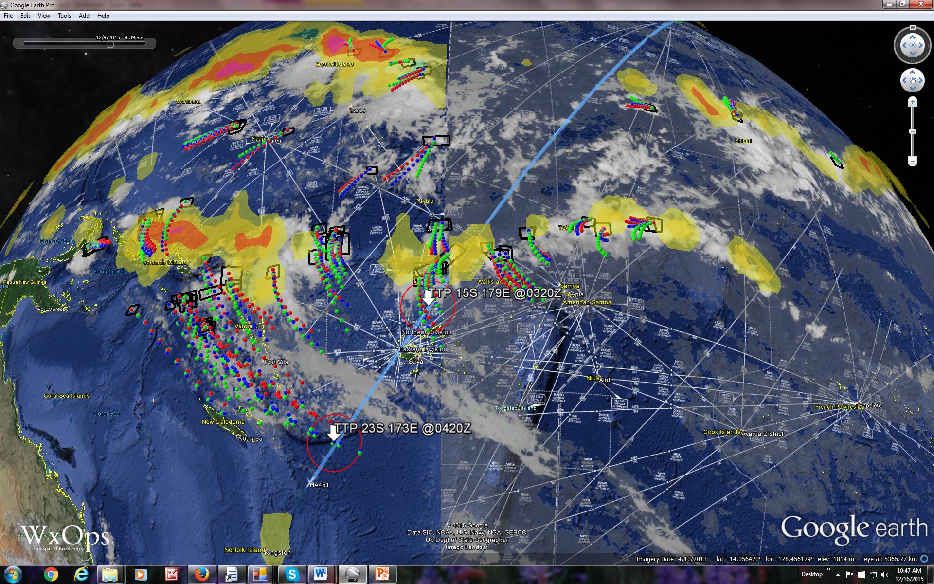
Professional siting analysis services for weather radar.Radar beam occultation by terrain, vegetation and manmade structures. Radio and optical atmospheric propagation and scintillation by turbulence. Reference: Shipley,S.T., A.Peterlin and S.Cantrell (2009) Radar visualization and occultation in 4-dimensions using Google Earth AMS 25th IIPS, Phoenix, AZ, 15 Jan 09 - CONUS 2008 NEXRAD occultation at wxanalyst.com/radar
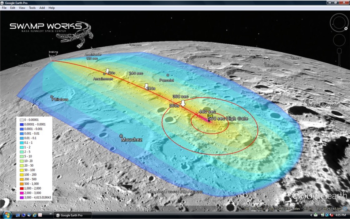
ESRI ArcGIS Pro analysis and exchange with Virtual Globes (e.g. Google Earth and NASA Worldwind). Reference: Shipley, S.T., Metzger, P.T. and J.E. Lane (2014) Lunar Cold Trap Contamination by Landing Vehicles. ASCE Earth and Space Conference, St. Louis, MO. Caption - Apollo 11 Landing with exhaust plume deposition onto Lunar surface.
Physical Optics design, analysis, and irradiance modeling. Eye Safety Plans in compliance with ACGIH TLV(TM) standards and NASA reference protocols. Reference: WxAnalyst R&D: Is GBE EyeSafe?
Prototyping for experimental projects. Conversion of Wx data information into Open Geospatial Consortium (OGC) formats. Support for scienctific investigations, field experiments, and real-time displays. Reference: Common Operating Environment for Aircraft Operations, US Patent No. 9,672,747B2 with Air-to-Air Communications, US Patent No. 9,916,764B2