![]() |
This page last updated 02 February 2009.
Virtual Globe Radar Project |
Interactive Index for Google Earth:
WxAnalyst's NEXRAD Index |
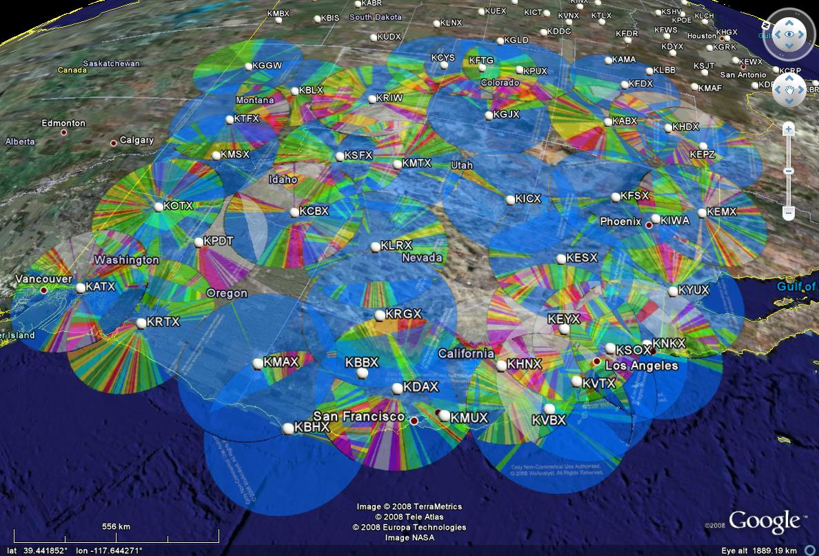
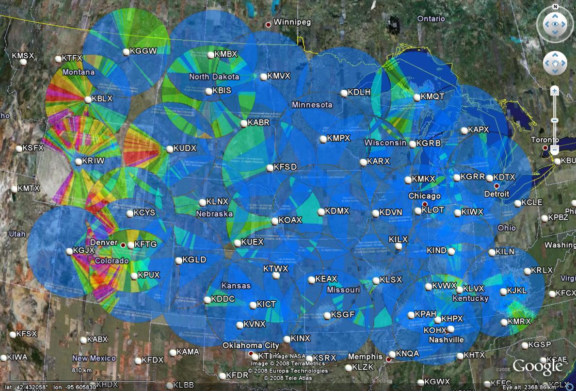
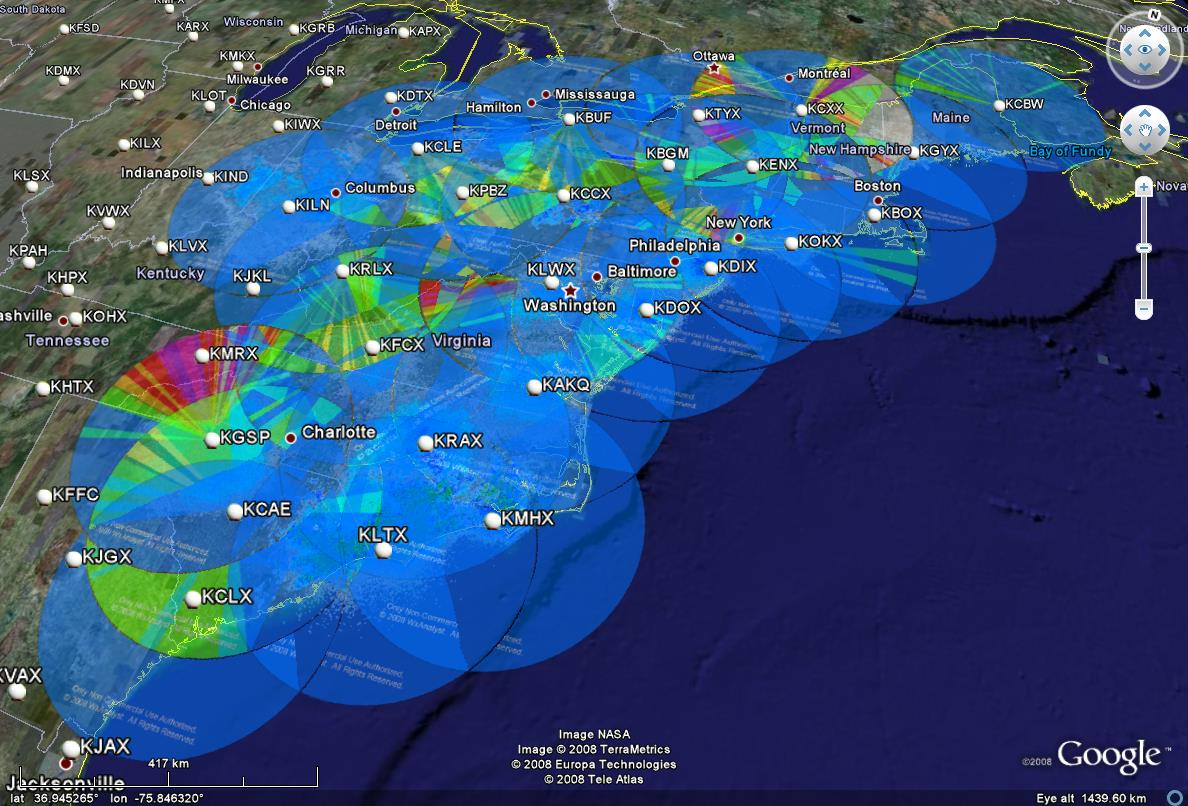
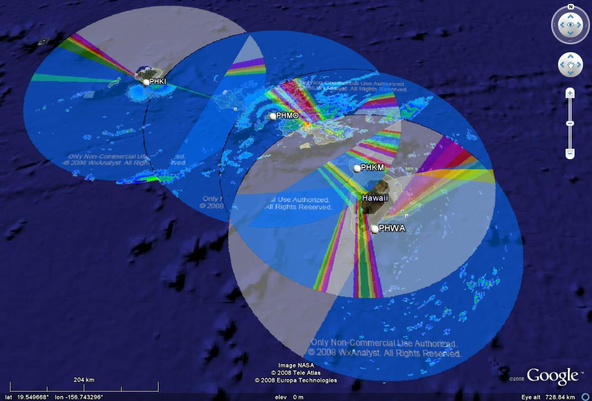
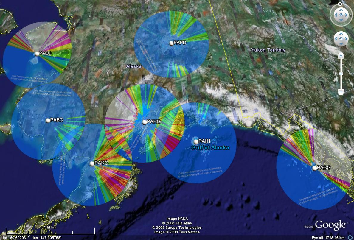
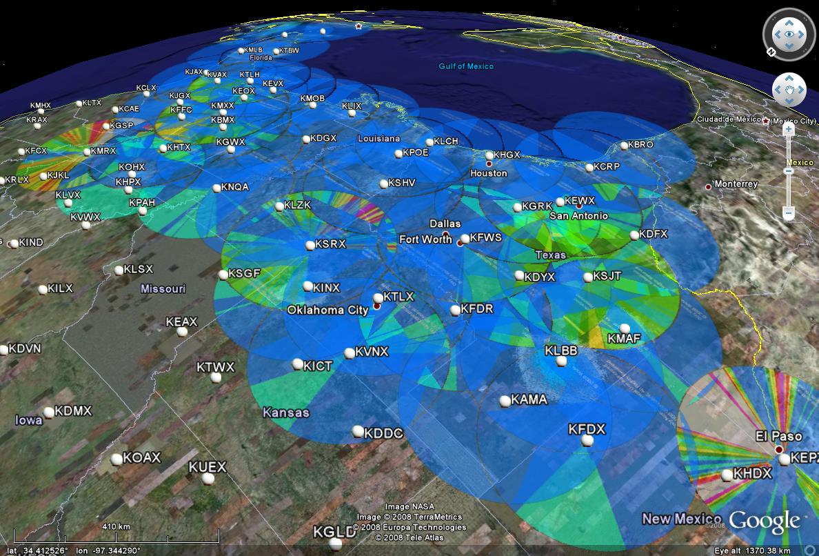
Terrain, vegetation and manmade structures can block or significantly reduce radar coverage.
WxAnalyst's advances include efficient high spatial resolution, manmade structures,
Virtual Globe visualization,
and Anomalous Propagation. Low resolution 3D radar occultation samples are published here for Google Earth. The data on these page are freely available for your personal use - commerical use subject to licensing and other restrictions. These data should be considered draft, and no warranty or guarantee is provided or implied.
Reference: Shipley, S.T., A. Peterlin and S. Cantrell (2009) Radar visualization and occultation in 4-dimensions using Google Earth AMS 25th IIPS, Phoenix, AZ, 15 Jan 09.
|
![]() 3D Occultation pattern at 0.5o elevation for NEXRAD at Sacramento, CA (KDAX), overlaid with radar reflectivity at 1825 UTC on 4 January 2008. Click on this image to access Google Earth web API. |
Complete Occultation Maps at 0.5 degree Beam Elevation | ||
---|---|---|
Western Region![]() |
Central Region![]() |
Eastern Region![]() |
Pacific Region![]() |
Alaska Region![]() |
Southern Region![]() |
US National Weather Service Radar Coverage (NWS) |
![]() |
Map of USA Weather Radars,
and Map Key for Occultation If you're running on a PC, you can left-click the links below, and "open with" Google Earth, OR try the "Quicklook" links in WxAnalyst's NEXRAD Index |
All material ©2010 by WxAnalyst, Ltd. - All rights reserved.
|